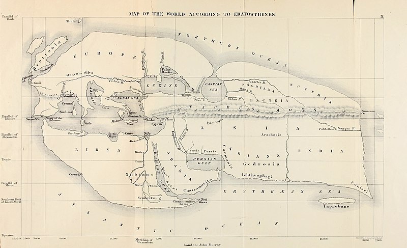
चित्र:Mappa di Eratostene.jpg

इस पूर्वावलोकन का आकार: ८०० × ४८७ पिक्सेल। दूसरे रेसोल्यूशन्स: ३२० × १९५ पिक्सेल | ६४० × ३९० पिक्सेल | १,०२४ × ६२३ पिक्सेल | १,२८० × ७७९ पिक्सेल | २,५६० × १,५५९ पिक्सेल | ५,०८५ × ३,०९६ पिक्सेल।
मूल चित्र (५,०८५ × ३,०९६ चित्रतत्व, संचिका का आकार: २.३७ MB, माइम प्रकार: image/jpeg)
चित्र का इतिहास
चित्र पुराने समय में कैसी दिखती थी यह जानने के लिए दिनांक/समय पर क्लिक करें।
| दिनांक/समय | थंबनेल | आकार | सदस्य | टिप्पणी | |
|---|---|---|---|---|---|
| वर्तमान | १४:५१, ५ जुलाई २०२० |  | ५,०८५ × ३,०९६ (२.३७ MB) | Sette-quattro | Higher resolution version, from https://archive.org/details/historyofancient00bunb/page/n720/mode/2up |
| १९:१२, २४ जून २००७ |  | १,०४० × ६११ (१४९ KB) | TcfkaPanairjdde | Mappa di Eratostene, da en.wiki en:Iran.jpg La mappa è tratta da: * Bunbury, E.H., ''A History of Ancient Geography among the Greeks and Romans from the Earliest Ages till the Fall of the Roman Empire''. London: John Murray, 1883. {{PD-Art}} |
चित्र का उपयोग
यह पृष्ठ इस चित्र का इस्तेमाल करता है:
चित्र का वैश्विक उपयोग
इस चित्र का उपयोग इन दूसरे विकियों में किया जाता है:
- af.wikipedia.org पर उपयोग
- ar.wikipedia.org पर उपयोग
- az.wikipedia.org पर उपयोग
- be-tarask.wikipedia.org पर उपयोग
- bs.wikipedia.org पर उपयोग
- ca.wikipedia.org पर उपयोग
- ceb.wikipedia.org पर उपयोग
- cs.wikipedia.org पर उपयोग
- de.wikipedia.org पर उपयोग
- diq.wikipedia.org पर उपयोग
- el.wikipedia.org पर उपयोग
- en.wikipedia.org पर उपयोग
- Alexander the Great
- Eratosthenes
- Seleucus I Nicator
- Persian Gulf naming dispute
- Taprobana
- Name of Iran
- Early world maps
- History of the Indo-Greek Kingdom
- User:Campstriker
- Sources of Indo-Greek history
- User:MinisterForBadTimes/Themistocles
- Homonoia
- Travel in classical antiquity
- User talk:Mdd/History of technical drawing
- User:Falcaorib
- es.wikipedia.org पर उपयोग
- eu.wikipedia.org पर उपयोग
- fa.wikipedia.org पर उपयोग
इस चित्र के वैश्विक उपयोग की अधिक जानकारी देखें।


